
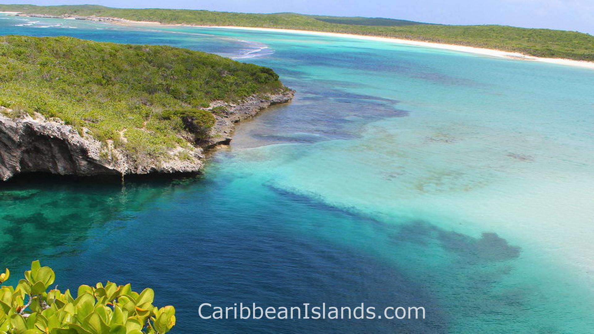
Long Island is 130 kilometers long and no more than 6 kilometers wide, running roughly north to south in the central Bahamas. The capital is Clarence Town. One road runs the full length of the island. The Tropic of Cancer crosses the northern quarter. The northeast coast is steep and rocky with cliffs facing the Atlantic. The southwest coast is flat, calm, and lined with wide white beaches. The two sides of the island look and feel nothing alike.
- Nearest airports: Deadman's Cay Airport (LGI / MYLD), Stella Maris Airport (SML / MYLS)
- Climate: Tropical. Warm and dry December to April, hot and wet June to October.
Why people visit Long Island
Dean's Blue Hole, west of Clarence Town, is the third deepest blue hole in the world at 202 meters. Most blue holes reach a maximum of around 110 meters. Dean's is enclosed on three sides by a natural rock amphitheater, with the fourth side opening to a white sand beach and turquoise lagoon. At 20 meters below the surface the hole widens from 30 meters across to a cavern 100 meters wide. New Zealand freediver William Trubridge has broken multiple world records here. The annual Vertical Blue freediving competition is held at the site. Entry is free.
Hamilton's Cave is the largest cave system in the Bahamas, with passages 50 feet wide and ceilings 10 feet high. Lucayan Taíno artifacts were discovered here in the 1930s, evidence that the Lucayans used the caves around 500 AD. The cave is on private land owned by the Cartwright family, who purchased it from the English Crown in 1847 for 27 pounds. Tours are guided by family members and require advance booking.
Cape Santa Maria Beach on the northern tip is consistently ranked among the most beautiful beaches in the world. The settlement at Clarence Town has two churches built by the same architect, Father Jerome Hawes, who also built The Hermitage on Cat Island. St. Paul's Anglican Church he built while still an Anglican priest. St. Peter and St. Paul's Catholic Church he designed after converting to Catholicism. Both still stand side by side in Clarence Town.
What made Long Island
The Lucayan Taíno were the first people here. Columbus may have visited. Some historians identify Long Island as Fernandina, the third island Columbus recorded visiting in October 1492. A stone monument on the northern tip at Columbus Point marks the shore where that landfall is believed to have occurred. The identification is debated but not dismissed. After the Spanish removed the Lucayans, the island stood largely empty until the Simms family arrived in 1720. Loyalist families followed in 1783, bringing enslaved Africans with them. Their descendants make up most of today's population of around 3,000 people.
The Deveaux family name that appears on Long Island connects to the same Colonel Andrew Deveaux who recaptured Nassau from Spain in 1783 and received land grants across the Bahamas as a reward. That same cross-island Loyalist network shaped most of the central Bahamas in the years immediately after American independence.
What you find
Long Island divides naturally along its length. The north has Stella Maris, the main tourist center, and the beaches around Cape Santa Maria. The middle holds Salt Pond, home of the annual Long Island Regatta, a traditional Bahamian sailing event drawing handmade wooden sloops from across the islands. The south holds Clarence Town, Dean's Blue Hole, and Hamilton's Cave. Conception Island, a national park and uninhabited green turtle nesting site, sits a short boat ride offshore. The island has no traffic lights and very little development outside its small settlements.
The islands of the Bahamas

Grand Bahama Island

Abacos, Bahamas

Exumas, Bahamas

Eleuthera and Harbour Island, Bahamas

Bimini, Bahamas

Andros, Bahamas

Berry Islands, Bahamas

Cat Island, Bahamas
Long Island, Bahamas

San Salvador, Bahamas

Inagua, Bahamas

Crooked & Acklins Islands, Bahamas

Mayaguana, Bahamas

The Bahamas